Spent yesterday afternoon in Dereham, Norfolk with Geography teachers from Norfolk schools in a network meeting organised by Rob Lodge.
There was an input from Martin King, who works for Norfolk County Council on GIS. He demonstrated some uses of GIS using ArcView, and talked about the large sums of money paid to OS for the license for the mapping data, which he hopes can be more widely used by teachers.
Good to see Terry and Graham from Downham Market, who had an OFSTED Subject inspection recently and had a good (with outstanding features) outcome...
Will be back in Norfolk on the 22nd of May for the Norfolk Geography Conference, where I will be presenting a workshop for the 6th consecutive year. The keynote is from Alan Kinder, who will be presenting on "Good Assessment in Geography: 2009 and Beyond".

Thanks to John Gardner and colleagues at Neatherd for hosting yesterday's event, and to Ben Utting and Kirsty Lansdale for their GIS contributions.
Here are the GIS links that I mentioned yesterday for those who didn't get them all down:
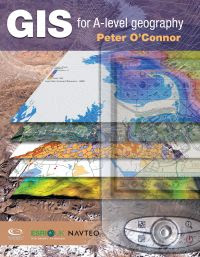
1. The GIS for 'A' level book by Peter O' Connor which comes with a year license for Arc View is available from the GA shop

2. Helen Young's GEOGRAPHY GEEK website has lots of AEGIS activities.
3. For an example of how the OS API (or 'application programming interface') can be used to put maps on your own website, check out David Rayner's GEOINTERACTIVE website. With a little bit of tinkering, you could have OS maps on your own school website...
4. The KEGS GIS site with loads of links with thanks to Bob Lang and colleagues at this school
5. GA Conference - sessions by ESRI and AEGIS, plus Google Earth options for GIS on April the 18th
6. Look out for next issue of OS Mapping News, which has as always, details on how to use mapping, as well as an excellent article on how to bring maps to life...
7. The NORFOLK DATA OBSERVATORY has a range of data for download and mapping - recommended visit
8. E-mail for 2 documents with ideas to take away (like my FAST FOOD resource...)
9. Make sure you have the latest version of GOOGLE EARTH.
Comments