Another initiative by Daniel Raven Ellison which we can get behind.
Free tickets available from Eventbrite.
More details here:
100 volunteers needed! Help create a network of 1,000+ walking routes connecting all of Great Britain's towns and cities - in just one day.

Hello,
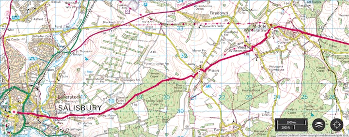
I'm a geographer, walker and campaigner. You can read more about my work and collaborations here. A few years ago, when planning a route between Salisbury and Winchester, I started to wonder...
What if there was a network of walking routes connecting all of Great Britain's towns and cities? And... why doesn't that exist already?
While there are thousands of miles of paths linking places across the country, there isn't a comprehensive network designed to help people walk off-road between all towns and cities. A breakthrough is needed.
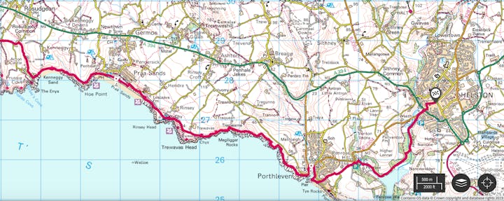
Using existing footpaths, Slow Ways is a bold collaborative project to design a network of over 1,000 routes that can be used to inspire and guide walking between towns, cities and villages. People will be able to use it to walk between neighbouring settlements or to combine multiple Slow Way routes for long-distance journeys.
This is an important, positive and timely project. Walking can improve health and wellbeing, tackle the climate and ecological emergencies, save people money, improve our environment and bring joy to people's lives.

I've teamed up with Ordnance Survey who I collaborate with as a GetOutside Champion.
Free tickets available from Eventbrite.
I'm looking for 100 volunteers to help create a network of 1,000+ walking routes connecting all of Great Britain's towns and cities - in just one day.— Daniel Raven-Ellison (@DanRavenEllison) November 29, 2019
Good at creating walking routes? Will you join me for the #SlowWays hack day on Feb 1st?https://t.co/0Djv8tD7Dh #GetOutside pic.twitter.com/LVMoIFNA1i
More details here:
100 volunteers needed! Help create a network of 1,000+ walking routes connecting all of Great Britain's towns and cities - in just one day.

Hello,
I'm a geographer, walker and campaigner. You can read more about my work and collaborations here. A few years ago, when planning a route between Salisbury and Winchester, I started to wonder...
What if there was a network of walking routes connecting all of Great Britain's towns and cities? And... why doesn't that exist already?
While there are thousands of miles of paths linking places across the country, there isn't a comprehensive network designed to help people walk off-road between all towns and cities. A breakthrough is needed.
Using existing footpaths, Slow Ways is a bold collaborative project to design a network of over 1,000 routes that can be used to inspire and guide walking between towns, cities and villages. People will be able to use it to walk between neighbouring settlements or to combine multiple Slow Way routes for long-distance journeys.
This is an important, positive and timely project. Walking can improve health and wellbeing, tackle the climate and ecological emergencies, save people money, improve our environment and bring joy to people's lives.

I've teamed up with Ordnance Survey who I collaborate with as a GetOutside Champion.
The entire Slow Ways network will be published and made freely available via Ordnance Survey.
100 Volunteers, 1 Day, 1000+ routes!
I'm looking for 100 volunteers to create the first draft of a "Slow Ways" network, on one day, in just 10 hours.
Are you up for it? You'll need to:
The Slow Ways hack day is being organised with support from the Kestrelman Trust. It is being held at Geovation (Ordnance Survey's innovation centre) and you'll be given lunch, dinner, snacks, tea, coffee and we'll have some drinks to celebrate at the end of the day too.
Everything we make will be made freely available online via OS maps . Whilst you'll own everything you create on the day, all volunteers need to be willing to share what’s created with the Slow Ways project too.
This is a unique opportunity to collaboratively create a beautiful, free and important new walking network for Great Britain.
100 Volunteers, 1 Day, 1000+ routes!
I'm looking for 100 volunteers to create the first draft of a "Slow Ways" network, on one day, in just 10 hours.
Are you up for it? You'll need to:
- be up for collaborating and sharing your efforts
- aged 14+
- be free from 10am to 8pm on February 1st
- get yourself to Geovation in central London
- be confident reading and using OS maps
- use the OS maps platform (with guidance) and be OK with their terms and conditions
- have a laptop you can work on
The Slow Ways hack day is being organised with support from the Kestrelman Trust. It is being held at Geovation (Ordnance Survey's innovation centre) and you'll be given lunch, dinner, snacks, tea, coffee and we'll have some drinks to celebrate at the end of the day too.
Everything we make will be made freely available online via OS maps . Whilst you'll own everything you create on the day, all volunteers need to be willing to share what’s created with the Slow Ways project too.
This is a unique opportunity to collaboratively create a beautiful, free and important new walking network for Great Britain.
Who knows who or what it will inspire?
I do hope that you're inspired by this idea and ready to help bring it to life.
See you on February 1st for the #slowways hack day?
Dan Raven-Ellison
I do hope that you're inspired by this idea and ready to help bring it to life.
See you on February 1st for the #slowways hack day?
Dan Raven-Ellison
See you there!
Comments