Another tip off from Ben Hennig is this Github mapping tool and script.
Open it up and navigate to a location, zoom in and change the angle of the map if necessary.
Open Settings and you will see various options for the creation of peaks on the map using height data.
These can be made more exagerrated, and the colour changed - messing with other settings produces different effects. Why not have a play?
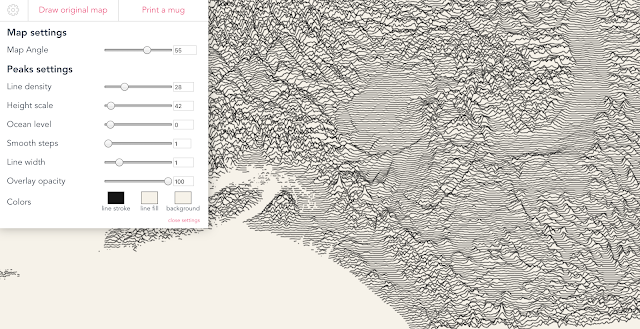
It's a way of making a Joy Division 'Unknown Pleasures' style image...
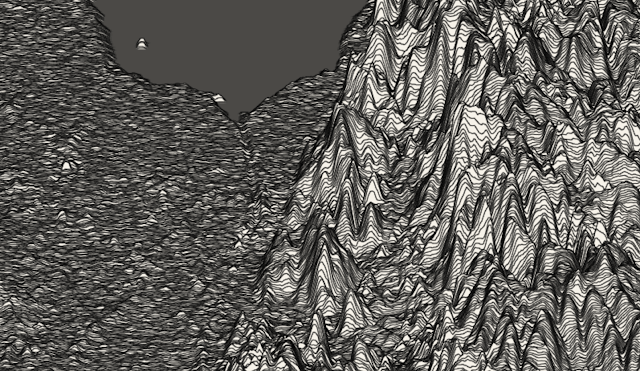
Here's a map of the island of Ely in the Fens... with the Ouse Washes the flat area running diagonally across.
 And here's one with the Wash and King's Lynn at the top - spot the edge of the Fens... see, Norfolk is actually far from flat...
Open it up and navigate to a location, zoom in and change the angle of the map if necessary.
Open Settings and you will see various options for the creation of peaks on the map using height data.
These can be made more exagerrated, and the colour changed - messing with other settings produces different effects. Why not have a play?

It's a way of making a Joy Division 'Unknown Pleasures' style image...
Here's a map of the island of Ely in the Fens... with the Ouse Washes the flat area running diagonally across.


Comments